Bath Skyline loop
Run · 6 miles · 55 min · 13 stops
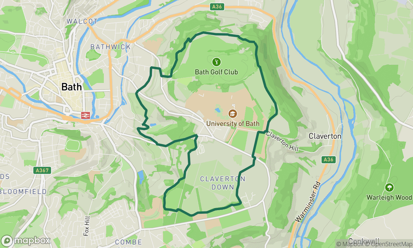
The National Trust's famous six-miler above the city: Sham Castle, hidden valleys and the best views of Bath's crescents. A proper trail run.
The National Trust's Skyline is Bath's favourite run for a reason: six miles of woods, meadows and follies with the whole city, crescents, abbey and all, laid out below. Muddy after rain, magical at sunrise.
The route, stop by stop
- Bathwick Fields
- Smallcombe Woods
- Widcombe Hill
- Rainbow Wood
- Claverton Down
- Claverton Down East
- Hengrove Wood
- Bathampton Wood
- Bathampton Down
- Sham Castle
- Bathwick Wood
- Bathwick Hill
- Bathwick Fields
Drive it with turn-by-turn
This route is built into Scenic Way. Open it, tap Run, and get full sat-nav with live traffic on iPhone and CarPlay. Your first 2 journeys are free.
Get Scenic Way on the App Store